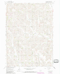
1963 Map of Closter SW
USGS Topo · Published 1985About this map
O'Neil Valley defines the western portion of this rural landscape, which was mapped in the early 1960s as part of the Department of the Interior's Missouri River Basin development project. The terrain is deeply etched by the drainage of Shell Creek and its tributary, Voorhees Creek, which carve a complex network of ridges and draws through the plains. This agrarian district in Boone County shows a sparse but organized settlement pattern of the era, where the social fabric was anchored by local landmarks like the South Branch Immanuel Ch. Researchers will find evidence of the district school system still in place, with School No 79, School No 57, and School No 34 spaced across the countryside. A small Cem is also recorded, providing a specific point of interest for genealogists tracing families in this corner of Nebraska.
Find a feature on this map
8 named features on this map. Tap any name to fly to it.
Don’t see what you’re looking for? This feature index may not catch every label — zoom into the map to look around manually.
Map Details
Editions of this 1963 Closter SW Map
2 editions found
Other maps of this area

1954 · Albion West
USGS Topo · 1:24,000

1955 · Broken Bow
USGS Topo · 1:250,000

1955 · Fremont
USGS Topo · 1:250,000

1956 · Broken Bow
USGS Topo · 1:250,000

1957 · Fremont
USGS Topo · 1:250,000

1958 · Fremont
USGS Topo · 1:250,000

1958 · Albion East
USGS Topo · 1:24,000

1963 · Petersburg
USGS Topo · 1:24,000

1963 · Closter SW
USGS Topo · 1:24,000

1963 · Closter SE
USGS Topo · 1:24,000