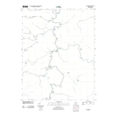
2011 Map of Clothier
USGS Topo · Published 2011About this map
Spruce Fork and its numerous tributaries, including Sixmile Creek and Hewett Creek, carve through this section of Logan County, West Virginia. The landscape is defined by the valley-floor settlements that follow these waterways, reflecting the region's historical reliance on narrow bottomlands for transportation and community life. Significant for genealogists, the area is dotted with family-named burial grounds such as Stolling Cemetery, multiple Ball Cemeteries, and Hager Cemetery. Postal hubs like the Ramage, Hewett, Sharples, and Blair serve as focal points for the small communities of Coal Valley, Ottawa, and Greenview. Terrain features like Indian Grave Hollow and Daniel Hollow speak to the local naming traditions of the Appalachian hollows, while the path of Spruce Laurel Fork indicates the complex drainage patterns of the coalfield highlands.
Find a feature on this map
83 named features on this map. Tap any name to fly to it.
Don’t see what you’re looking for? This feature index may not catch every label — zoom into the map to look around manually.
Map Details
Editions of this 2011 Clothier Map
This is the sole edition of this map. No revisions or reprints were ever made.
Other maps of this area

1891 · Oceana
USGS Topo · 1:125,000

1893 · Oceana
USGS Topo · 1:125,000

1898 · Oceana
USGS Topo · 1:125,000

1899 · Charleston
USGS Topo · 1:125,000

1909 · Peytona
USGS Topo · 1:48,000

1910 · Bald Knob
USGS Topo · 1:48,000

1911 · Peytona
USGS Topo · 1:62,500

1911 · Madison
USGS Topo · 1:62,500

1912 · Bald Knob
USGS Topo · 1:62,500

1913 · Logan
USGS Topo · 1:62,500