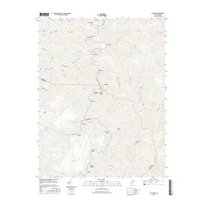
2016 Map of Clothier
USGS Topo · Published 2016About this map
Spruce Fork snakes through the heart of the southern West Virginia coalfields, anchoring a dense network of valley settlements and mining-era infrastructure. This 2016 survey highlights the rugged topography of Boone and Logan counties, where narrow hollows like Indian Grave Hollow and Daniel Hollow define the habitable landscape. The map provides a detailed look at the corridor connecting Clothier, Sharples, and Blair, illustrating how roads like the Spruce River Road follow the tight contours of the land. Genealogists will find a wealth of family-named sites, including the Ball Cemeteries, Adkins Cem, and Pauley Cem. Modern landmarks, such as the Sharple Stag Memorial Bridge, stand alongside legacy place names like Coal Valley and Five Block, reflecting the deep industrial and social history of these Appalachian mountain communities.
Find a feature on this map
89 named features on this map. Tap any name to fly to it.
Don’t see what you’re looking for? This feature index may not catch every label — zoom into the map to look around manually.
Map Details
Editions of this 2016 Clothier Map
This is the sole edition of this map. No revisions or reprints were ever made.
Other maps of this area

1891 · Oceana
USGS Topo · 1:125,000

1893 · Oceana
USGS Topo · 1:125,000

1898 · Oceana
USGS Topo · 1:125,000

1899 · Charleston
USGS Topo · 1:125,000

1909 · Peytona
USGS Topo · 1:48,000

1910 · Bald Knob
USGS Topo · 1:48,000

1911 · Peytona
USGS Topo · 1:62,500

1911 · Madison
USGS Topo · 1:62,500

1912 · Bald Knob
USGS Topo · 1:62,500

1913 · Logan
USGS Topo · 1:62,500