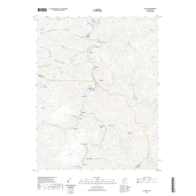
2019 Map of Clothier
USGS Topo · Published 2019About this map
Spruce Fork and the Spruce River carve through the center of this 2019 survey, defining a corridor of coal-country settlements along the Boone and Logan County line. The map traces a dense network of valley communities from Greenview and Ramage in the north down through Jeffrey, Ottawa, and Clothier, terminating at Blair in the south. These mountain towns are deeply connected to the river and road systems, with local landmarks like the Sharple Stag Memorial Bridge near Sharples providing critical infrastructure. Family history is etched into the hillsides through numerous small burial grounds, including Hale Cem, Ball Cem, and Browning Cem. The topography is marked by significant hollows and points, such as Daniel Hollow and Brushy Point, which hem in the residential developments found at Sodom, Monclo, and Five Block.
Find a feature on this map
95 named features on this map. Tap any name to fly to it.
Don’t see what you’re looking for? This feature index may not catch every label — zoom into the map to look around manually.
Map Details
Editions of this 2019 Clothier Map
This is the sole edition of this map. No revisions or reprints were ever made.
Other maps of this area

1891 · Oceana
USGS Topo · 1:125,000

1893 · Oceana
USGS Topo · 1:125,000

1898 · Oceana
USGS Topo · 1:125,000

1899 · Charleston
USGS Topo · 1:125,000

1909 · Peytona
USGS Topo · 1:48,000

1910 · Bald Knob
USGS Topo · 1:48,000

1911 · Peytona
USGS Topo · 1:62,500

1911 · Madison
USGS Topo · 1:62,500

1912 · Bald Knob
USGS Topo · 1:62,500

1913 · Logan
USGS Topo · 1:62,500