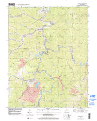
1996 Map of Clothier
USGS Topo · Published 2002About this map
The Guyan River and Spruce Fork define the industrial and residential corridors of this West Virginia coal country landscape during the mid-1990s. Heavy industrial activity is evident through numerous Strip Mine operations and infrastructure such as the Tipple Conveyor and Tipple at Monclo. The settlement pattern follows the narrow valleys, with tight-knit communities like Clothier, Sharples, and Ottawa established along the watercourses. Local social foundations are well-represented, including the Sharples High Sch, Laurel City Sch, and numerous family burial grounds like the Adkins Cem and Browning Cem. The map illustrates a complex network of resource extraction, with a Pipeline and various gas wells threading between the hollows of Daniel Hollow and Chestnut Indian Grave Hollow.
Find a feature on this map
82 named features on this map. Tap any name to fly to it.
Don’t see what you’re looking for? This feature index may not catch every label — zoom into the map to look around manually.
Map Details
Editions of this 1996 Clothier Map
This is the sole edition of this map. No revisions or reprints were ever made.
Other maps of this area

1891 · Oceana
USGS Topo · 1:125,000

1893 · Oceana
USGS Topo · 1:125,000

1898 · Oceana
USGS Topo · 1:125,000

1899 · Charleston
USGS Topo · 1:125,000

1909 · Peytona
USGS Topo · 1:48,000

1910 · Bald Knob
USGS Topo · 1:48,000

1911 · Peytona
USGS Topo · 1:62,500

1911 · Madison
USGS Topo · 1:62,500

1912 · Bald Knob
USGS Topo · 1:62,500

1913 · Logan
USGS Topo · 1:62,500