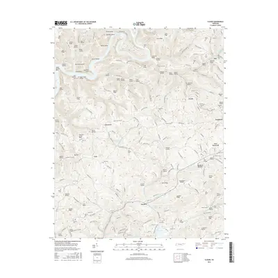
2016 Map of Clouds
USGS Topo · Published 2016About this map
Powell River meanders through the northern section of this landscape, carving deep bends like Capps Hollow Bend before the terrain shifts toward the southern waters of Norris Lake. The area is defined by a dense network of ridges and hollows, where small settlements such as Goin, Clouds, and Lily Grove are established along the valley floors and higher ground. This 2016 survey documents a rural Claiborne County landscape where family history is deeply embedded in the land, evidenced by the high concentration of small burial grounds including Minton Cem, Poore Cem, and Skaggs Cem. The intersection of traditional topography and modern water management is visible near Sandlick, where the reach of the reservoir influences the local drainage patterns of Sandlick Cr and Big Barren Cr.
Find a feature on this map
207 named features on this map. Tap any name to fly to it.
Don’t see what you’re looking for? This feature index may not catch every label — zoom into the map to look around manually.
Map Details
Editions of this 2016 Clouds Map
This is the sole edition of this map. No revisions or reprints were ever made.
Other maps of this area

1886 · Cumberland Gap
USGS Topo · 1:125,000

1888 · Cumberland Gap
USGS Topo · 1:125,000

1891 · Cumberland Gap
USGS Topo · 1:125,000

1897 · Maynardville
USGS Topo · 1:125,000

1900 · Maynardville
USGS Topo · 1:125,000

1903 · Middlesboro
USGS Topo · 1:48,000

1927 · Middlesboro
USGS Topo · 1:62,500

1930 · Middlesboro
USGS Topo · 1:62,500

1935 · Mingo Mountains
USGS Topo · 1:24,000

1935 · Cumberland Gap
USGS Topo · 1:24,000