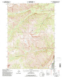
1991 Map of Clouds Home Peak
USGS Topo · Published 1996About this map
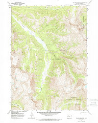
Wapiti Ridge and the high elevations of Clouds Home Peak dominate this topographical study of the Absaroka Range within the Shoshone National Forest. This 1991 revision, based on 1969 aerial photography, documents a protected landscape where the Washakie Wilderness boundary dictates land use and access. The drainage patterns of Ishawooa Creek and Deer Creek illustrate the high-relief environment, carving deep paths through Ishawooa Mesa and the surrounding peaks. Geologists and topographical enthusiasts will note the distinct landforms such as Horses Head and Gobblers Knob, which provide clear landmarks for navigating this remote terrain. The map also traces the Twelfth Standard Parallel North, a key surveying line that anchors the geographic coordinates of the high wilderness.
Find a feature on this map
17 named features on this map. Tap any name to fly to it.
Don’t see what you’re looking for? This feature index may not catch every label — zoom into the map to look around manually.
Map Details
Editions of this 1991 Clouds Home Peak Map
This is the sole edition of this map. No revisions or reprints were ever made.
Other maps of this area

1893 · Ishawooa
USGS Topo · 1:125,000

1895 · Ishawooa
USGS Topo · 1:125,000

1899 · Ishawooa
USGS Topo · 1:125,000

1955 · Cody
USGS Topo · 1:250,000

1958 · Cody
USGS Topo · 1:250,000

1962 · Cody
USGS Topo · 1:250,000
1970 · Sheep Mesa
USGS Topo · 1:24,000
1970 · Fall Creek
USGS Topo · 1:24,000
1970 · Ptarmigan Mountain
USGS Topo · 1:24,000
1970 · Yellow Mountain
USGS Topo · 1:24,000