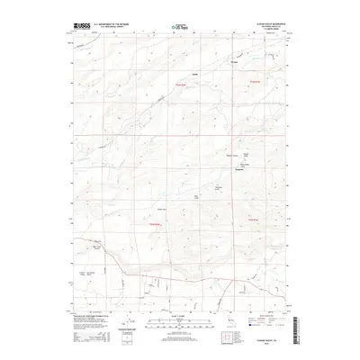
2015 Map of Clough Gulch
USGS Topo · Published 2015About this map
S Cow Cr Forebay and the rugged canyon systems of the eastern Sacramento Valley define this transition from the valley floor into the foothills. The terrain is marked by numerous named drainages, including Clough Gulch, Wagoner Canyon, and Bear Creek Canyon, which have shaped the settlement and transit patterns of the region. Small communities such as Pawnee, Smith, and Wagoner are scattered along the major road corridors like Whitmore Rd and Oak Run Rd. A network of smaller, often privately named lanes such as Camino Real, Tompata Trl, and Merrilea Ln suggests a landscape of rural residences and agricultural holdings. The map captures the complex hydrography where Old Cow Cr, S Cow Cr, and Bear Cr descend toward the central valley, illustrating the critical role of water management in this part of Shasta County.
Find a feature on this map
45 named features on this map. Tap any name to fly to it.
Don’t see what you’re looking for? This feature index may not catch every label — zoom into the map to look around manually.
Map Details
Editions of this 2015 Clough Gulch Map
This is the sole edition of this map. No revisions or reprints were ever made.
Other maps of this area

1886 · Lassen Peak
USGS Topo · 1:250,000

1890 · Red Bluff
USGS Topo · 1:250,000

1892 · Lassen Peak
USGS Topo · 1:250,000

1894 · Lassen Peak
USGS Topo · 1:250,000

1894 · Red Bluff
USGS Topo · 1:250,000

1901 · Redding
USGS Topo · 1:125,000

1935 · Burney
USGS Topo · 1:96,000

1935 · Paynes Creek
USGS Topo · 1:96,000

1939 · Burney
USGS Topo · 1:125,000

1941 · Mineral
USGS Topo · 1:125,000