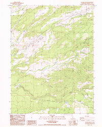
1985 Map of Clough Gulch
USGS Topo · Published 1986About this map
Cow Creek and its many tributaries, including Old Cow Creek and South Cow Creek, define the water and power infrastructure of this Shasta County landscape in the mid-1980s. The presence of the Cow Creek Powerhouse, connected to a Siphon, Penstock, and Cow Creek Forebay, illustrates the complex hydraulic engineering used to harness the region's sharp elevation changes. Agricultural and rural activity is anchored around Hufford, while several Borrow Pit excavations and a Landing Strip suggest ongoing resource management and accessibility.
Find a feature on this map
31 named features on this map. Tap any name to fly to it.
Don’t see what you’re looking for? This feature index may not catch every label — zoom into the map to look around manually.
Map Details
Editions of this 1985 Clough Gulch Map
This is the sole edition of this map. No revisions or reprints were ever made.
Other maps of this area

1886 · Lassen Peak
USGS Topo · 1:250,000

1890 · Red Bluff
USGS Topo · 1:250,000

1892 · Lassen Peak
USGS Topo · 1:250,000

1894 · Lassen Peak
USGS Topo · 1:250,000

1894 · Red Bluff
USGS Topo · 1:250,000

1901 · Redding
USGS Topo · 1:125,000

1935 · Burney
USGS Topo · 1:96,000

1935 · Paynes Creek
USGS Topo · 1:96,000

1939 · Burney
USGS Topo · 1:125,000

1941 · Mineral
USGS Topo · 1:125,000