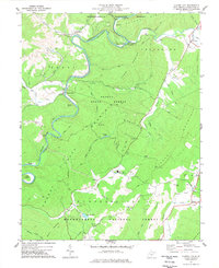
1977 Map of Clover Lick
USGS Topo · Published 1977About this map
The Greenbrier River carves a winding path through the heart of the Monongahela National Forest, defining the rugged topography of Pocahontas County. This 1970s landscape shows the persistent corridor of the Chesapeake and Ohio railroad as it parallels the water, connecting small riverside settlements like Stony Bottom and Sitlington. The map captures a moment when rural life centered around local landmarks such as Dilleys Mill and Alexander Ch, alongside more modern additions like the County High Sch WT.
Find a feature on this map
63 named features on this map. Tap any name to fly to it.
Don’t see what you’re looking for? This feature index may not catch every label — zoom into the map to look around manually.
Map Details
Editions of this 1977 Clover Lick Map
2 editions found
Other maps of this area

1891 · Huntersville
USGS Topo · 1:125,000

1894 · Huntersville
USGS Topo · 1:125,000

1901 · Monterey
USGS Topo · 1:125,000

1922 · Cass
USGS Topo · 1:48,000

1923 · Marlinton
USGS Topo · 1:48,000

1923 · Warm Springs
USGS Topo · 1:48,000

1923 · Mingo
USGS Topo · 1:48,000

1924 · Cass
USGS Topo · 1:62,500

1925 · Mingo
USGS Topo · 1:62,500

1925 · Marlinton
USGS Topo · 1:62,500