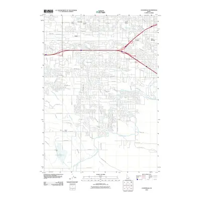
2010 Map of Cloverdale
USGS Topo · Published 2010About this map
Cloverdale and the surrounding high desert of the Boise Valley are defined by a sophisticated network of early 20th-century irrigation, visible here as the area transitions from rural agricultural roots to suburban expansion. The massive New York Canal and Ridenbaugh Canal dominate the landscape, feeding a web of smaller ditches like the Settlers Canal, Wilson Fruit Lateral, and Painter Lateral. These waterways transformed the arid plain into productive farmland, supporting settlements at Beatty, Perkins, and Boise Junction. To the south, the Hubbard Dam regulates the water supply near the Tenmile Rodeo Grounds, while the presence of Terrace Lawn Cemetery, Cloverdale Memorial Park, and Mountain View Cemetery highlights the long-standing community centers established during the region's initial development. This survey documents the critical intersection of water rights and residential growth in Ada County.
Find a feature on this map
67 named features on this map. Tap any name to fly to it.
Don’t see what you’re looking for? This feature index may not catch every label — zoom into the map to look around manually.
Map Details
Editions of this 2010 Cloverdale Map
This is the sole edition of this map. No revisions or reprints were ever made.
Other maps of this area

1892 · Boise
USGS Topo · 1:125,000

1892 · Bisuka
USGS Topo · 1:125,000

1894 · Bisuka
USGS Topo · 1:125,000

1897 · Boise
USGS Topo · 1:125,000

1953 · Eagle
USGS Topo · 1:24,000

1953 · Cloverdale
USGS Topo · 1:24,000

1953 · Meridian
USGS Topo · 1:24,000

1953 · Star
USGS Topo · 1:24,000

1954 · Boise South
USGS Topo · 1:24,000

1954 · Boise North
USGS Topo · 1:24,000