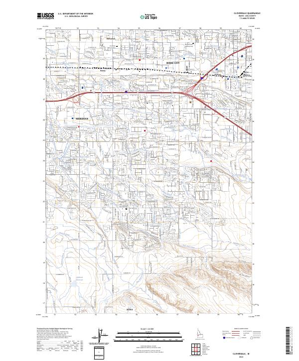
2024 Map of Cloverdale
USGS Topo · Published 2024About this map
Boise City and the adjacent communities of Meridian and Kuna define this modern landscape of the Treasure Valley. The territory is intricately laced with an extensive irrigation network, including the substantial New York Canal and Ridenbaugh Canal, alongside numerous laterals like the Eightmile Lateral and Wilson Fruit Lateral. These waterways, crucial to the region's agricultural development, now wind through expanding residential and institutional sectors. Significant educational landmarks such as the College of Western Idaho - Ada County Campus and Carrington College appear alongside historical local centers like Cloverdale and Perkins. In the southern portion of the sheet, the terrain opens toward the Hubbard Reservoir and the Mason Creek Feeder, where the industrial and transport infrastructure of I-84 and I-184 facilitates the continued growth of the Boise metropolitan area.
Find a feature on this map
49 named features on this map. Tap any name to fly to it.
Don’t see what you’re looking for? This feature index may not catch every label — zoom into the map to look around manually.
Map Details
Editions of this 2024 Cloverdale Map
This is the sole edition of this map. No revisions or reprints were ever made.
Other maps of this area

1892 · Boise
USGS Topo · 1:125,000

1892 · Bisuka
USGS Topo · 1:125,000

1894 · Bisuka
USGS Topo · 1:125,000

1897 · Boise
USGS Topo · 1:125,000

1953 · Eagle
USGS Topo · 1:24,000

1953 · Cloverdale
USGS Topo · 1:24,000

1953 · Meridian
USGS Topo · 1:24,000

1953 · Star
USGS Topo · 1:24,000

1954 · Boise South
USGS Topo · 1:24,000

1954 · Boise North
USGS Topo · 1:24,000