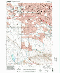
1998 Map of Cloverdale
USGS Topo · Published 2002About this map
Hubbard Reservoir and a complex web of irrigation canals define this landscape on the western edge of Boise and eastern Meridian. The map captures the late 20th-century transition of the Treasure Valley from agricultural roots to suburban expansion, evidenced by the intricate system of laterals like the Snider Lateral and Boller Lateral alongside emerging residential blocks. Local institutions such as George Fox Univ. and Maple Grove Sch anchor the growing neighborhoods, while traditional landmarks like the Tenmile Rodeo Grounds reflect the area’s rural heritage. Water management remains central to the geography, with the Ridenbaugh Canal and New York Canal cutting across the terrain to support the valley's development. This survey serves as a precise record of the regional footprint before the turn of the millennium, documenting old rail sidings at Perkins and Boise Junction.
Find a feature on this map
50 named features on this map. Tap any name to fly to it.
Don’t see what you’re looking for? This feature index may not catch every label — zoom into the map to look around manually.
Map Details
Editions of this 1998 Cloverdale Map
This is the sole edition of this map. No revisions or reprints were ever made.
Other maps of this area

1892 · Boise
USGS Topo · 1:125,000

1892 · Bisuka
USGS Topo · 1:125,000

1894 · Bisuka
USGS Topo · 1:125,000

1897 · Boise
USGS Topo · 1:125,000

1953 · Eagle
USGS Topo · 1:24,000

1953 · Cloverdale
USGS Topo · 1:24,000

1953 · Meridian
USGS Topo · 1:24,000

1953 · Star
USGS Topo · 1:24,000

1954 · Boise South
USGS Topo · 1:24,000

1954 · Boise North
USGS Topo · 1:24,000