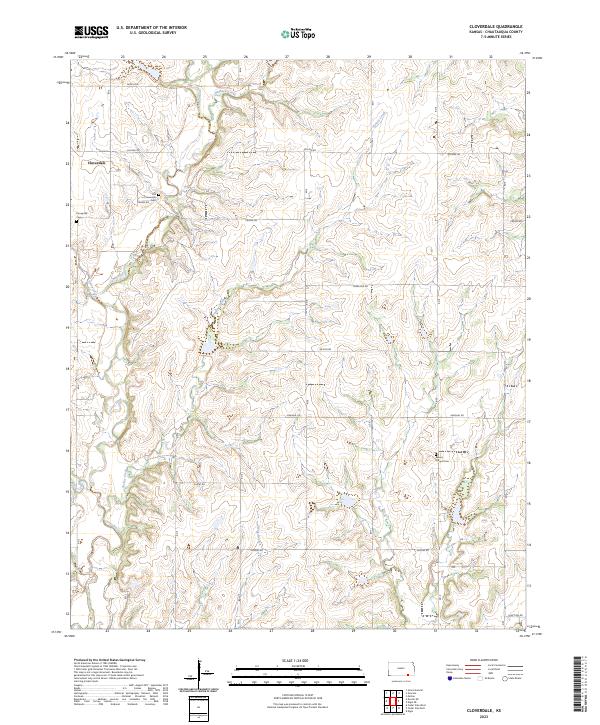
2023 Map of Cloverdale
USGS Topo · Published 2023About this map
Caney River and its numerous tributaries, including Turkey Creek and Union Creek, carve a complex drainage pattern across this section of Chautauqua County. The settlement of Cloverdale serves as a central landmark in a landscape defined by ranching and agriculture, where the section lines are traced by a network of rural routes such as Quivira Rd and Kansas Rd. This 2023 survey provides essential data for genealogists tracing family ties to the area's early congregations and burial grounds. The map clearly identifies several significant local landmarks, including the Old Cloverdale Cem, Caneyville Cem, and Round Mound Cem, offering a contemporary view of these established community sites. The terrain is further characterized by minor waterways like Hogback Creek, Otter Creek, and Spring Branch, which follow the natural contours of the Kansas plains.
Find a feature on this map
25 named features on this map. Tap any name to fly to it.
Don’t see what you’re looking for? This feature index may not catch every label — zoom into the map to look around manually.
Map Details
Editions of this 2023 Cloverdale Map
This is the sole edition of this map. No revisions or reprints were ever made.
Other maps of this area

1885 · Sedan
USGS Topo · 1:125,000

1889 · Burden
USGS Topo · 1:125,000

1889 · Sedan
USGS Topo · 1:125,000

1955 · Wichita
USGS Topo · 1:250,000

1958 · Wichita
USGS Topo · 1:250,000
1962 · Cedar Vale West
USGS Topo · 1:24,000

1962 · Moline
USGS Topo · 1:24,000

1962 · Grand Summit
USGS Topo · 1:24,000
1962 · Cedar Vale East
USGS Topo · 1:24,000

1962 · Elgin NE
USGS Topo · 1:24,000