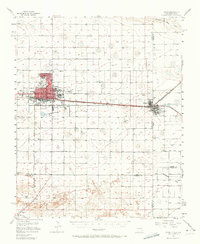
1957 Map of Clovis
USGS Topo · Published 1973About this map
The city of Clovis dominates the high plains landscape of Curry County in the mid-1950s, serving as a vital rail and ranching hub. The extensive Atchison Topeka and Santa Fe railroad infrastructure, including a sprawling yard and numerous oil tanks, underscores the industrial importance of the region. Just across the state line, the twin towns of Texico and Farwell sit at the junction of several rail lines, marking the border between New Mexico and Texas.
Find a feature on this map
36 named features on this map. Tap any name to fly to it.
Don’t see what you’re looking for? This feature index may not catch every label — zoom into the map to look around manually.
Map Details
Editions of this 1957 Clovis Map
3 editions found
Other maps of this area

1954 · Clovis
USGS Topo · 1:250,000

1957 · Portair
USGS Topo · 1:62,500

1957 · Clovis
USGS Topo · 1:62,500

1957 · Arch
USGS Topo · 1:62,500

1957 · Portales
USGS Topo · 1:62,500

1957 · Pleasant Hill
USGS Topo · 1:62,500

1957 · Hammond Ranch
USGS Topo · 1:62,500

1958 · Clovis
USGS Topo · 1:250,000

1962 · Birdwell Ranch
USGS Topo · 1:24,000

1963 · Lariat
USGS Topo · 1:24,000