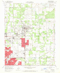
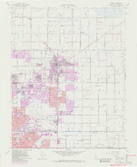
1964 Map of Clovis
USGS Topo · Published 1965About this map
The growing city of Clovis sits at the heart of this mid-1960s survey, flanked by the expanding northern reaches of Fresno. The landscape is a structured grid of agricultural fields and residential developments, defined by a complex irrigation network including the Enterprise Canal and Clovis Ditch. This era marks a significant period of suburban transition, where family-named roads like Shepherd Ave and Herndon Ave intersect with established rail corridors of the Southern Pacific and Atchison Topeka and Santa Fe.
Find a feature on this map
62 named features on this map. Tap any name to fly to it.
Don’t see what you’re looking for? This feature index may not catch every label — zoom into the map to look around manually.
Map Details
Editions of this 1964 Clovis Map
5 editions found
Other maps of this area

1921 · Bullard
USGS Topo · 1:31,680

1922 · Round Mountain
USGS Topo · 1:31,680

1922 · Lanes Bridge
USGS Topo · 1:31,680

1922 · Friant
USGS Topo · 1:31,680

1923 · Malaga
USGS Topo · 1:31,680

1923 · Academy
USGS Topo · 1:31,680

1923 · Fresno
USGS Topo · 1:31,680

1923 · Clovis
USGS Topo · 1:31,680

1923 · Sanger
USGS Topo · 1:31,680

1923 · Bullard
USGS Topo · 1:31,680