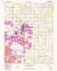
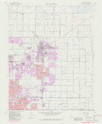
1964 Map of Clovis
USGS Topo · Published 1982About this map
The agrarian and urban boundary of the San Joaquin Valley is clearly defined in this 1960s study, updated with purple photorevisions to track the expansion of Clovis and Fresno. The map centers on the transition from the grid-aligned orchards and vineyards of the central valley to the burgeoning residential developments. Substantial infrastructure for the era is visible, including the Fresno Air Terminal and several military installations like the Fresno Air National Guard and the U S Reservation.
Find a feature on this map
67 named features on this map. Tap any name to fly to it.
Don’t see what you’re looking for? This feature index may not catch every label — zoom into the map to look around manually.
Map Details
Editions of this 1964 Clovis Map
5 editions found
Other maps of this area

1921 · Bullard
USGS Topo · 1:31,680

1922 · Round Mountain
USGS Topo · 1:31,680

1922 · Lanes Bridge
USGS Topo · 1:31,680

1922 · Friant
USGS Topo · 1:31,680

1923 · Malaga
USGS Topo · 1:31,680

1923 · Academy
USGS Topo · 1:31,680

1923 · Fresno
USGS Topo · 1:31,680

1923 · Clovis
USGS Topo · 1:31,680

1923 · Sanger
USGS Topo · 1:31,680

1923 · Bullard
USGS Topo · 1:31,680