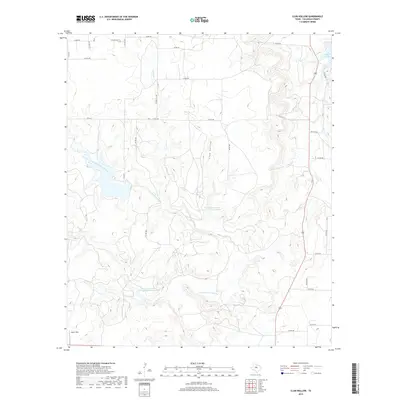
2019 Map of Club Hollow
USGS Topo · Published 2019About this map
North Prong Pecan Bayou and its winding tributaries dominate this portion of Callahan County, illustrating a landscape defined by seasonal watercourses and conservation efforts. The presence of the Soil Conservation Service Site 9 Reservoir and Soil Conservation Service Site 6 Reservoir highlights mid-century land management practices intended to control erosion and manage runoff in the drainage basins of Rough Cr and Mexia Cr. The terrain is characterized by the namesake Club Hollow, a significant drainage feature cutting through the limestone-crowned hills of the Edwards Plateau's northern fringe. Human activity is marked by scattered landing strips like Owen Field and a network of rural routes such as Union Hill Rd, which connect remote ranching properties and small water bodies like Baird Lake in the northeast corner.
Find a feature on this map
35 named features on this map. Tap any name to fly to it.
Don’t see what you’re looking for? This feature index may not catch every label — zoom into the map to look around manually.
Map Details
Editions of this 2019 Club Hollow Map
This is the sole edition of this map. No revisions or reprints were ever made.
Other maps of this area

1890 · Abilene
USGS Topo · 1:125,000

1892 · Abilene
USGS Topo · 1:125,000

1931 · Baird
USGS Topo · 1:125,000

1932 · Baird
USGS Topo · 1:125,000

1954 · Abilene
USGS Topo · 1:250,000

1957 · Kirby Lake
USGS Topo · 1:62,500

1958 · Abilene
USGS Topo · 1:250,000
1966 · Baird
USGS Topo · 1:24,000

1966 · Admiral
USGS Topo · 1:24,000
1966 · Cub Hollow
USGS Topo · 1:24,000