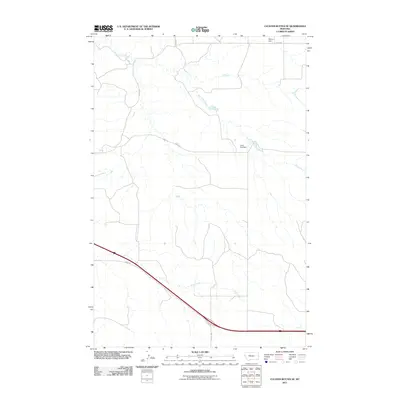
2011 Map of Cluster Buttes SE
USGS Topo · Published 2011About this map
Box Elder Creek meanders through this portion of Dawson County, carving a distinct drainage pattern across the landscape of eastern Montana. The map highlights the localized water management systems essential to this region, specifically Blyton Dam in the north and John Job Dam further south along the creek's path. These features, along with Krug Creek in the southern section, illustrate the hydraulic infrastructure used to support land use in this semi-arid environment.
Find a feature on this map
8 named features on this map. Tap any name to fly to it.
Don’t see what you’re looking for? This feature index may not catch every label — zoom into the map to look around manually.
Map Details
Editions of this 2011 Cluster Buttes SE Map
This is the sole edition of this map. No revisions or reprints were ever made.
Other maps of this area

1909 · Glendive
USGS Topo · 1:250,000

1953 · Miles City
USGS Topo · 1:250,000

1954 · Glendive
USGS Topo · 1:250,000

1957 · Miles City
USGS Topo · 1:250,000

1957 · Glendive
USGS Topo · 1:250,000

1958 · Miles City
USGS Topo · 1:250,000

1958 · Glendive
USGS Topo · 1:250,000

1981 · Glendive
USGS Topo · 1:100,000

1981 · Wibaux
USGS Topo · 1:100,000

1982 · Hodges
USGS Topo · 1:24,000