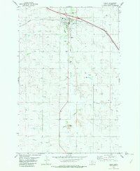
1981 Map of Wibaux
USGS Topo · Published 1982About this map
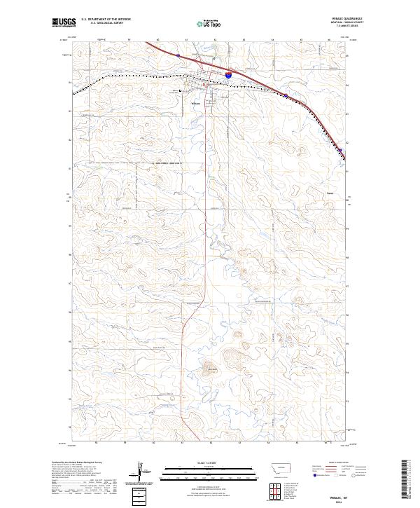
The Yellowstone River cuts across the northwest corner of this 1981 landscape, a region defined by the transition from the high plains of Eastern Montana into North Dakota. This map documents a critical corridor for the Burlington Northern railroad, which follows the river and connects the town of Wibaux with neighbors like Yates and the border community of Beach. The area is characterized by an extensive network of intermittent drainages and small ranching reservoirs, including Upper Magpie Res and Prairie Goat Reservoir, reflecting the water management essential to this arid rangeland.
Find a feature on this map
78 named features on this map. Tap any name to fly to it.
Don’t see what you’re looking for? This feature index may not catch every label — zoom into the map to look around manually.
Map Details
Editions of this 1981 Wibaux Map
This is the sole edition of this map. No revisions or reprints were ever made.
Historical Maps of Beach Through Time
7 maps found