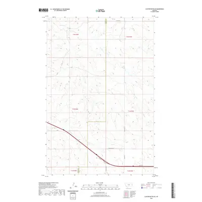
2020 Map of Cluster Buttes SE
USGS Topo · Published 2020About this map
Krug Cr and Box Elder Cr drain the high prairie landscape along the border of Dawson and Wibaux counties. This 2020 survey reveals a rural expanse dominated by large-scale agricultural and ranching parcels, structured by the Public Land Survey System as indicated by the prominent township and range lines like t15n r58e. Modern transportation infrastructure is concentrated in the southern portion of the quadrangle, where a major interstate corridor is flanked by Frontage Rd and Fortage Rd, providing essential connectivity for local landholders.
Find a feature on this map
19 named features on this map. Tap any name to fly to it.
Don’t see what you’re looking for? This feature index may not catch every label — zoom into the map to look around manually.
Map Details
Editions of this 2020 Cluster Buttes SE Map
This is the sole edition of this map. No revisions or reprints were ever made.
Other maps of this area

1909 · Glendive
USGS Topo · 1:250,000

1953 · Miles City
USGS Topo · 1:250,000

1954 · Glendive
USGS Topo · 1:250,000

1957 · Miles City
USGS Topo · 1:250,000

1957 · Glendive
USGS Topo · 1:250,000

1958 · Miles City
USGS Topo · 1:250,000

1958 · Glendive
USGS Topo · 1:250,000

1981 · Glendive
USGS Topo · 1:100,000

1981 · Wibaux
USGS Topo · 1:100,000

1982 · Hodges
USGS Topo · 1:24,000