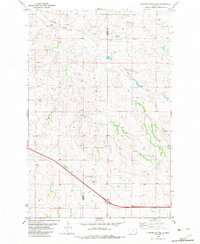
1982 Map of Cluster Buttes SE
USGS Topo · Published 1983About this map
Dawson and Wibaux counties meet along a rugged boundary defined by seasonal drainages and essential water sources in this eastern Montana landscape. The terrain is deeply etched by Elder Creek and Box Elder Creek in the north, while Krug Creek cuts across the southwestern corner of the sheet. This map captures the area in the early 1980s, revealing a sparse ranching landscape where survival is marked by the placement of numerous Spring and Well locations. Human impact on the land is minimal but functional, evidenced by a Gravel Pit near the southern boundary and a network of unimproved roads that navigate the complex coulees. The map serves as a primary record of the hydrological network and land division between these two counties before modern development, offering a clear view of the rural infrastructure during this period of Montana's history.
Find a feature on this map
8 named features on this map. Tap any name to fly to it.
Don’t see what you’re looking for? This feature index may not catch every label — zoom into the map to look around manually.
Map Details
Editions of this 1982 Cluster Buttes SE Map
This is the sole edition of this map. No revisions or reprints were ever made.
Other maps of this area

1909 · Glendive
USGS Topo · 1:250,000

1953 · Miles City
USGS Topo · 1:250,000

1954 · Glendive
USGS Topo · 1:250,000

1957 · Miles City
USGS Topo · 1:250,000

1957 · Glendive
USGS Topo · 1:250,000

1958 · Miles City
USGS Topo · 1:250,000

1958 · Glendive
USGS Topo · 1:250,000

1981 · Glendive
USGS Topo · 1:100,000

1981 · Wibaux
USGS Topo · 1:100,000

1982 · Hodges
USGS Topo · 1:24,000