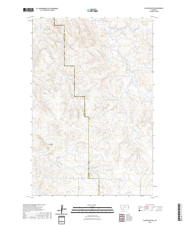
2024 Map of Cluster Buttes
USGS Topo · Published 2024About this map
Cluster Buttes rises above a landscape defined by an intricate network of drainages and seasonal watercourses along the boundary of Dawson Co and Wibaux Co. This part of eastern Montana is dominated by the upper reaches of the Cottonwood Creek system, including the North Fork and South Fork. The topography is characterized by a dense series of coulees and ridges, with Castle Creek cutting through the western portion of the quadrangle.
Find a feature on this map
13 named features on this map. Tap any name to fly to it.
Don’t see what you’re looking for? This feature index may not catch every label — zoom into the map to look around manually.
Map Details
Editions of this 2024 Cluster Buttes Map
This is the sole edition of this map. No revisions or reprints were ever made.
Other maps of this area

1909 · Glendive
USGS Topo · 1:250,000

1954 · Glendive
USGS Topo · 1:250,000

1957 · Glendive
USGS Topo · 1:250,000

1958 · Glendive
USGS Topo · 1:250,000

1966 · Savage SE
USGS Topo · 1:24,000

1966 · Savage SW
USGS Topo · 1:24,000

1981 · Glendive
USGS Topo · 1:100,000
1982 · Cluster Buttes SW
USGS Topo · 1:24,000
1982 · Cluster Buttes SE
USGS Topo · 1:24,000
1982 · Odland Dam NW
USGS Topo · 1:24,000