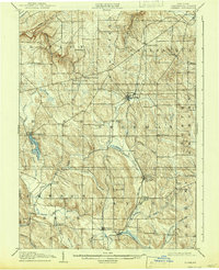
1905 Map of Clymer
USGS Topo · Published 1942About this map
Sherman and Clymer anchor this corner of Chautauqua County, where the dairy and timber landscape was meticulously surveyed between 1902 and 1904. The geography is defined by a dense network of small dairy settlements and crossroad hamlets like Wait Corners, Sheldon Corners, and King Corners. Transportation was critical to these rural economies, illustrated by the Pennsylvania RR corridor and the New York Central RR connecting farmers to larger markets. Waterways such as French Creek and Findley Lake provided both irrigation and industrial potential, while the rolling terrain is marked by distinctive rises like Clymer Hill and Sweet Hill. This survey captures the height of the early 20th-century agrarian layout before the consolidation of rural schools and the modernization of local roadways.
Find a feature on this map
48 named features on this map. Tap any name to fly to it.
Don’t see what you’re looking for? This feature index may not catch every label — zoom into the map to look around manually.
Map Details
Editions of this 1905 Clymer Map
4 editions found
Other maps of this area

1899 · Westfield
USGS Topo · 1:62,500

1900 · Dunkirk
USGS Topo · 1:62,500

1904 · Chautaqua
USGS Topo · 1:62,500

1905 · Clymer
USGS Topo · 1:62,500

1913 · North East
USGS Topo · 1:62,500

1915 · North East
USGS Topo · 1:62,500

1926 · Youngsville
USGS Topo · 1:62,500

1929 · Corry
USGS Topo · 1:48,000

1929 · Youngsville
USGS Topo · 1:62,500

1929 · Union City
USGS Topo · 1:62,500