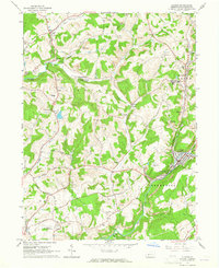
1963 Map of Clymer
USGS Topo · Published 1965About this map
Clymer and the surrounding townships of Rayne and Green define this mid-century portrait of Pennsylvania’s bituminous coal country. The landscape is heavily marked by the region's industrial heritage, featuring numerous strip mines and gas wells alongside the Cherry Tree and Dixonville and Baltimore and Ohio railroads. These rail lines follow the winding paths of Dixon Run and Two Lick Creek, connecting local operations with wider markets.
Find a feature on this map
69 named features on this map. Tap any name to fly to it.
Don’t see what you’re looking for? This feature index may not catch every label — zoom into the map to look around manually.
Map Details
Editions of this 1963 Clymer Map
4 editions found
Other maps of this area

1902 · Indiana
USGS Topo · 1:62,500

1902 · Barnesboro
USGS Topo · 1:62,500

1904 · Barnesboro
USGS Topo · 1:62,500

1906 · Punxsutawney
USGS Topo · 1:62,500

1909 · Smicksburg
USGS Topo · 1:62,500

1938 · Smicksburg
USGS Topo · 1:62,500

1939 · Smicksburg
USGS Topo · 1:62,500

1939 · Punxsutawney
USGS Topo · 1:62,500

1942 · Punxsutawney
USGS Topo · 1:62,500

1943 · Punxsutawney
USGS Topo · 1:125,000
Featured Places
- Rayne Township, PA
- Clymer, PA
- Dixonville, Green Township
- Tanoma, Rayne Township
- Gaiblton, Rayne Township