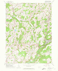
1963 Map of Clymer
USGS Topo · Published 1972About this map
Clymer and the surrounding coal-country settlements of central Indiana County appear here in the early 1960s, a landscape defined by deep valleys and the industrial influence of the Baltimore and Ohio railroad. The map documents an area transitioning through its extractive history, where numerous Strip Mines and gas wells dot the ridges between rural communities like Dixonville and Tanoma. A significant local landmark is the County Airport (Jimmy Stewart Field), named for the iconic actor and Indiana native, located near the southern boundary in White township.
Find a feature on this map
51 named features on this map. Tap any name to fly to it.
Don’t see what you’re looking for? This feature index may not catch every label — zoom into the map to look around manually.
Map Details
Editions of this 1963 Clymer Map
4 editions found
Other maps of this area

1902 · Indiana
USGS Topo · 1:62,500

1902 · Barnesboro
USGS Topo · 1:62,500

1904 · Barnesboro
USGS Topo · 1:62,500

1906 · Punxsutawney
USGS Topo · 1:62,500

1909 · Smicksburg
USGS Topo · 1:62,500

1938 · Smicksburg
USGS Topo · 1:62,500

1939 · Smicksburg
USGS Topo · 1:62,500

1939 · Punxsutawney
USGS Topo · 1:62,500

1942 · Punxsutawney
USGS Topo · 1:62,500

1943 · Punxsutawney
USGS Topo · 1:125,000
Featured Places
- Rayne Township, PA
- Clymer, PA
- Dixonville, Green Township
- Tanoma, Rayne Township
- Gaiblton, Rayne Township