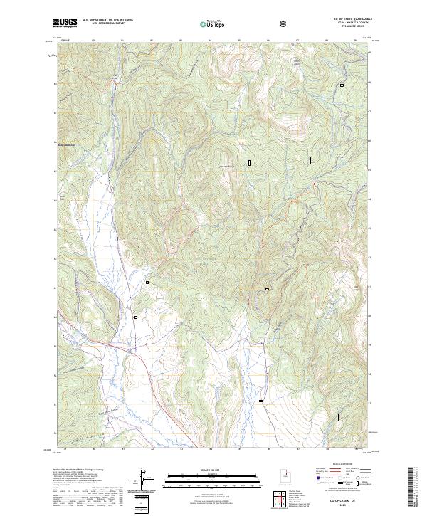
2023 Map of Co-op Creek
USGS Topo · Published 2023About this map
The Wasatch Range landscape documented in this 2023 edition is defined by an intricate network of seasonal trails and water management systems within the Uinta National Forest. The map reveals a complex infrastructure of winter recreation and water diversion, featuring the Strawberry Ditch and the Currant Creek Feeder Canal which navigate the high-elevation terrain. Settlement patterns are sparse, represented by localized areas like Independence and the high-mountain flats of Mill B Flat and Dock Flat.
Find a feature on this map
45 named features on this map. Tap any name to fly to it.
Don’t see what you’re looking for? This feature index may not catch every label — zoom into the map to look around manually.
Map Details
Editions of this 2023 Co-op Creek Map
This is the sole edition of this map. No revisions or reprints were ever made.
Other maps of this area

1885 · Salt Lake
USGS Topo · 1:250,000

1907 · Strawberry Valley
USGS Topo · 1:125,000

1909 · Strawberry Valley
USGS Topo · 1:125,000

1954 · Salt Lake City
USGS Topo · 1:250,000

1958 · Salt Lake City
USGS Topo · 1:250,000

1960 · Salt Lake City
USGS Topo · 1:250,000

1966 · Strawberry Reservoir NW
USGS Topo · 1:24,000
1966 · Strawberry Reservoir NE
USGS Topo · 1:24,000

1967 · Two Tom Hill
USGS Topo · 1:24,000
1967 · Center Creek
USGS Topo · 1:24,000