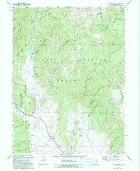
1993 Map of Co-Op Creek
USGS Topo · Published 1993About this map
Uinta National Forest lands dominate this high-country landscape, where the Strawberry River and its various tributaries have carved deep valleys through the mountainous terrain. The map documents an intricate network of water resources, including numerous Springs and named sources like Bull Spring in the southern reaches. Evidence of early industry and land use is present in features such as the Sugar Mill near Hollow and several labeled Quarries, while the historic Indian Reservation Boundary cuts across the northwest corner.
Find a feature on this map
43 named features on this map. Tap any name to fly to it.
Don’t see what you’re looking for? This feature index may not catch every label — zoom into the map to look around manually.
Map Details
Editions of this 1993 Co-Op Creek Map
This is the sole edition of this map. No revisions or reprints were ever made.
Other maps of this area

1885 · Salt Lake
USGS Topo · 1:250,000

1907 · Strawberry Valley
USGS Topo · 1:125,000

1909 · Strawberry Valley
USGS Topo · 1:125,000

1954 · Salt Lake City
USGS Topo · 1:250,000

1958 · Salt Lake City
USGS Topo · 1:250,000

1960 · Salt Lake City
USGS Topo · 1:250,000

1966 · Strawberry Reservoir NW
USGS Topo · 1:24,000
1966 · Strawberry Reservoir NE
USGS Topo · 1:24,000

1967 · Two Tom Hill
USGS Topo · 1:24,000
1967 · Center Creek
USGS Topo · 1:24,000