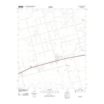
2010 Map of Coahoma
USGS Topo · Published 2010About this map
Coahoma serves as the central hub of this West Texas landscape, positioned along a major transit corridor that includes Pacific Ave and several ranch-to-market roads. The topography is defined by the modest elevation of Wildhorse Mountain to the northeast and a series of drainages including Wildhorse Creek, Beals Creek, and Moss Creek. To the west, the settlements of Sand Springs and Midway follow the primary road network, illustrating a classic linear development pattern common in the region's ranching and oil-adjacent history.
Find a feature on this map
39 named features on this map. Tap any name to fly to it.
Don’t see what you’re looking for? This feature index may not catch every label — zoom into the map to look around manually.
Map Details
Editions of this 2010 Coahoma Map
This is the sole edition of this map. No revisions or reprints were ever made.
Other maps of this area

1941 · Big Spring South
USGS Topo · 1:62,500

1942 · Big Spring South
USGS Topo · 1:62,500

1942 · Big Spring North
USGS Topo · 1:62,500

1951 · Vincent
USGS Topo · 1:24,000

1951 · Iatan
USGS Topo · 1:24,000

1952 · Iatan
USGS Topo · 1:24,000

1954 · Big Spring
USGS Topo · 1:250,000

1954 · Big Spring North
USGS Topo · 1:24,000

1954 · Big Spring North NE
USGS Topo · 1:24,000

1958 · Big Spring
USGS Topo · 1:250,000