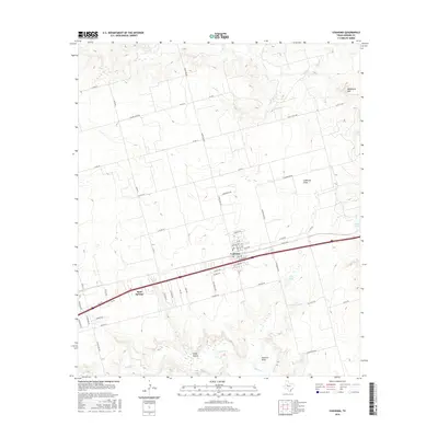
2016 Map of Coahoma
USGS Topo · Published 2016About this map
Coahoma serves as the central hub for this Texas landscape, situated along a busy transportation corridor where the local street grid intersects several regional routes. The settlement of Sand Springs lies further west, connected by an extensive network of county roads like Salem Rd and Ranch Rd 820. This area of Howard County is defined by its drainage patterns and low-lying basins, including Sandy Hollow and several ephemeral water bodies such as Iatan Lake and Allen Lake. To the northeast, the topography rises toward the prominent height of Wildhorse Mtn. The landscape is etched by a series of draws and creeks, most notably Coahoma Draw, Wildhorse Cr, and Beals Cr, which reveal the natural hydrology of the region alongside modern developments and oil field infrastructure.
Find a feature on this map
63 named features on this map. Tap any name to fly to it.
Don’t see what you’re looking for? This feature index may not catch every label — zoom into the map to look around manually.
Map Details
Editions of this 2016 Coahoma Map
This is the sole edition of this map. No revisions or reprints were ever made.
Other maps of this area

1941 · Big Spring South
USGS Topo · 1:62,500

1942 · Big Spring South
USGS Topo · 1:62,500

1942 · Big Spring North
USGS Topo · 1:62,500

1951 · Vincent
USGS Topo · 1:24,000

1951 · Iatan
USGS Topo · 1:24,000

1952 · Iatan
USGS Topo · 1:24,000

1954 · Big Spring
USGS Topo · 1:250,000

1954 · Big Spring North
USGS Topo · 1:24,000

1954 · Big Spring North NE
USGS Topo · 1:24,000

1958 · Big Spring
USGS Topo · 1:250,000