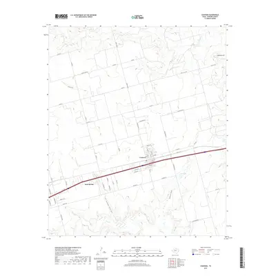
2019 Map of Coahoma
USGS Topo · Published 2019About this map
Coahoma and the neighboring settlement of Sand Springs define this high plains landscape of Howard County, Texas. This area is characterized by a series of intermittent watercourses and draws that cut through the terrain, including Coahoma Draw and the prominent Sandy Hollow. To the northeast, the elevation rises toward Wildhorse Mtn, a notable landmark overlooking the intersection of Wildhorse Cr and several local routes like Old City Rd.
Find a feature on this map
61 named features on this map. Tap any name to fly to it.
Don’t see what you’re looking for? This feature index may not catch every label — zoom into the map to look around manually.
Map Details
Editions of this 2019 Coahoma Map
This is the sole edition of this map. No revisions or reprints were ever made.
Other maps of this area

1941 · Big Spring South
USGS Topo · 1:62,500

1942 · Big Spring South
USGS Topo · 1:62,500

1942 · Big Spring North
USGS Topo · 1:62,500

1951 · Vincent
USGS Topo · 1:24,000

1951 · Iatan
USGS Topo · 1:24,000

1952 · Iatan
USGS Topo · 1:24,000

1954 · Big Spring
USGS Topo · 1:250,000

1954 · Big Spring North
USGS Topo · 1:24,000

1954 · Big Spring North NE
USGS Topo · 1:24,000

1958 · Big Spring
USGS Topo · 1:250,000