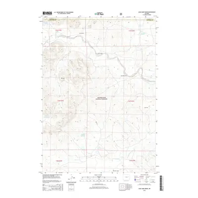
2015 Map of Coal Bank Draw
USGS Topo · Published 2015About this map
Thunder Basin National Grassland dominates this high plains landscape on the border of Campbell and Converse Counties. The area is defined by its complex drainage systems and water management, with numerous named draws and reservoirs scattered across the terrain. These includes significant catchments such as Morton Number 1 Reservoir, Dorr Reservoir, and Beckwith Reservoir. The Red Hills rise above the drainage of Antelope Cr, providing a distinctive landmark in this part of the Powder River Basin. The presence of roads like Irwin Rd and Alvord Dr highlights the remote but managed nature of these public lands. Small watercourses like Woody Cr and Bad Cr eventually feed into the Dry Fork Cheyenne River at the southern edge of the quadrangle, illustrating the importance of every small draw and creek in this semi-arid ranching and grazing country.
Find a feature on this map
28 named features on this map. Tap any name to fly to it.
Don’t see what you’re looking for? This feature index may not catch every label — zoom into the map to look around manually.
Map Details
Editions of this 2015 Coal Bank Draw Map
This is the sole edition of this map. No revisions or reprints were ever made.
Other maps of this area

1955 · Newcastle
USGS Topo · 1:250,000

1958 · Newcastle
USGS Topo · 1:250,000

1959 · Betty Reservoir
USGS Topo · 1:62,500

1971 · Fiddleback Ranch
USGS Topo · 1:24,000

1971 · Coal Bank Draw
USGS Topo · 1:24,000

1971 · Teckla
USGS Topo · 1:24,000

1971 · Esau Spring
USGS Topo · 1:24,000

1971 · Piney Canyon SW
USGS Topo · 1:24,000

1971 · Piney Canyon SE
USGS Topo · 1:24,000

1971 · Tin Can Lake
USGS Topo · 1:24,000