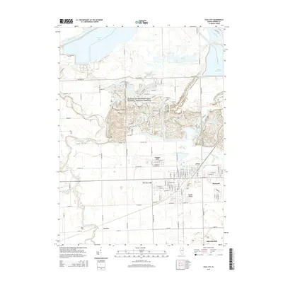
2015 Map of Coal City
USGS Topo · Published 2015About this map
The Illinois and Michigan Canal National Heritage Corridor dominates the northern landscape of this region, reflecting the area's transition from 19th-century industrial powerhouse to modern conservation and recreation space. Centered on Coal City, the map illustrates a complex network of water management and energy infrastructure, including Heidecke Lake and the Dresden Cooling Lake. The intricate contour lines around Sand Ridge and the Mazon River indicate a legacy of surface mining and geological change in the Grundy County area. Genealogy researchers can find family history sites at Holderman Cem and Short Cem, while local historians can trace the development of smaller communities like Carbon Hill, Eileen, and Harrisonville that grew alongside the regional coal industry.
Find a feature on this map
113 named features on this map. Tap any name to fly to it.
Don’t see what you’re looking for? This feature index may not catch every label — zoom into the map to look around manually.
Map Details
Editions of this 2015 Coal City Map
This is the sole edition of this map. No revisions or reprints were ever made.
Other maps of this area

1892 · Morris
USGS Topo · 1:62,500

1892 · Wilmington
USGS Topo · 1:62,500

1918 · Wilmington
USGS Topo · 1:62,500

1918 · Morris
USGS Topo · 1:62,500

1923 · Herscher
USGS Topo · 1:62,500

1925 · Herscher
USGS Topo · 1:62,500

1948 · Dwight
USGS Topo · 1:62,500

1950 · Dwight
USGS Topo · 1:62,500

1953 · Morris
USGS Topo · 1:24,000

1953 · Lisbon
USGS Topo · 1:24,000