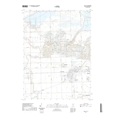
2021 Map of Coal City
USGS Topo · Published 2021About this map
Coal City and its surrounding cluster of mining settlements—Carbon Hill, Eileen, and Diamond—anchor this portion of Grundy County. The landscape is heavily defined by the legacy of resource extraction, with the characteristic topography of industrial activity appearing south of Sand Ridge and around Heidecke Lake. To the north, the Illinois River and Kankakee River converge just east of the Dresden Cooling Lake, marking a critical hydrological junction for the region. Historical markers of early settlement remain visible in the form of Holderman Cem and Short Cem, while the southern reaches of the map show the rural junction at Gorman near the West Fork Mazon River. The dense grid of Coal City contrasts sharply with the nearby Hope Field, reflecting the era's transition from intensive industry to modern land use patterns.
Find a feature on this map
118 named features on this map. Tap any name to fly to it.
Don’t see what you’re looking for? This feature index may not catch every label — zoom into the map to look around manually.
Map Details
Editions of this 2021 Coal City Map
This is the sole edition of this map. No revisions or reprints were ever made.
Other maps of this area

1892 · Morris
USGS Topo · 1:62,500

1892 · Wilmington
USGS Topo · 1:62,500

1918 · Wilmington
USGS Topo · 1:62,500

1918 · Morris
USGS Topo · 1:62,500

1923 · Herscher
USGS Topo · 1:62,500

1925 · Herscher
USGS Topo · 1:62,500

1948 · Dwight
USGS Topo · 1:62,500

1950 · Dwight
USGS Topo · 1:62,500

1953 · Morris
USGS Topo · 1:24,000

1953 · Lisbon
USGS Topo · 1:24,000