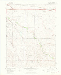
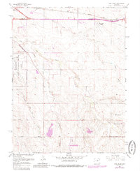
1966 Map of Coal Creek
USGS Topo · Published 1967About this map
Buckley Air National Guard Base and the emerging Aurora Corporate Boundary define this landscape on the eastern edge of the Denver metro area during the mid-1960s. The map illustrates a transitional period where traditional prairie land and drainage systems like Coal Creek and Murphy Creek began to meet suburban expansion and infrastructure development. Aviation and transport footprints are prominent, from the Union Pacific rail line and Airline Road in the south to the East Colfax Airpark and Radio Towers near the northern boundary. Numerous Gravel Pit sites scattered along the creek beds highlight the local extraction industry supporting the region's mid-century growth. The terrain is marked by several ephemeral watercourses, including Senac Creek and First Creek, which carve through the open Mesa and military reservations.
Find a feature on this map
23 named features on this map. Tap any name to fly to it.
Don’t see what you’re looking for? This feature index may not catch every label — zoom into the map to look around manually.
Map Details
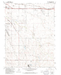
Editions of this 1966 Coal Creek Map
6 editions found
Other maps of this area

1890 · East Denver
USGS Topo · 1:125,000

1935 · East Denver Nos. 3 and 4
USGS Topo · 1:48,000

1938 · Long Branch
USGS Topo · 1:24,000

1939 · Coal Creek
USGS Topo · 1:24,000

1940 · Piney Creek
USGS Topo · 1:24,000

1941 · Long Branch
USGS Topo · 1:31,680

1941 · Fitzsimons
USGS Topo · 1:31,680

1942 · Box Elder School
USGS Topo · 1:31,680

1942 · Parker
USGS Topo · 1:31,680

1942 · Piney Creek
USGS Topo · 1:31,680