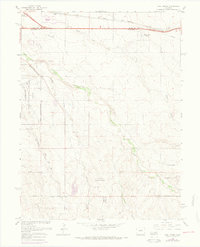
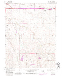
1966 Map of Coal Creek
USGS Topo · Published 1973About this map
Buckley Air National Guard Base dominates the western edge of this Colorado landscape, marking a period of significant military and aeronautical expansion on the outskirts of Denver. The map reveals a transition from open ranching and agricultural land, indicated by the small settlement of Pritchard, to a more specialized 1960s economy featuring the Century 21 International Speedway and the East Colfax Airpark. Infrastructure is anchored by the Union Pacific railroad corridor and historical thoroughfares like Airline Road. The natural geography is defined by a series of north-flowing intermittent streams, including Murphy Creek, Senac Creek, and Coal Creek, which carve subtle drainages across the terrain. Large tracts of land are designated as Military Reservation, preserving much of the open space even as the Aurora Corporate Boundary begins to press into the southeastern plains.
Find a feature on this map
21 named features on this map. Tap any name to fly to it.
Don’t see what you’re looking for? This feature index may not catch every label — zoom into the map to look around manually.
Map Details
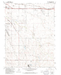
Editions of this 1966 Coal Creek Map
6 editions found
Other maps of this area

1890 · East Denver
USGS Topo · 1:125,000

1935 · East Denver Nos. 3 and 4
USGS Topo · 1:48,000

1938 · Long Branch
USGS Topo · 1:24,000

1939 · Coal Creek
USGS Topo · 1:24,000

1940 · Piney Creek
USGS Topo · 1:24,000

1941 · Long Branch
USGS Topo · 1:31,680

1941 · Fitzsimons
USGS Topo · 1:31,680

1942 · Box Elder School
USGS Topo · 1:31,680

1942 · Parker
USGS Topo · 1:31,680

1942 · Piney Creek
USGS Topo · 1:31,680