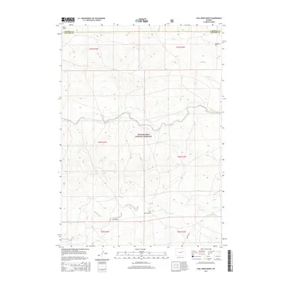
2015 Map of Coal Draw North
USGS Topo · Published 2015About this map
Thunder Basin National Grassland dominates this portion of northeastern Wyoming, where the high plains landscape is defined by its seasonal drainage network and cattle ranching heritage. The map details a complex system of waterways, including Antelope Cr and Sand Cr, alongside man-made improvements like the Betty-Supply Ditch. These water sources are vital to the remote operations found here, such as the Dilts Ranch Airport, which serves as a critical point of access in a region of few major roads. The terrain is marked by distinctive topographic features like Antelope Flat, Buck Draw, and Coal Draw, reflecting the area's geological and mining potential. Evidence of local travel is preserved in the route of Jenne Trail Rd, which cuts through the southern reaches of the township grid at the Campbell and Converse County line.
Find a feature on this map
19 named features on this map. Tap any name to fly to it.
Don’t see what you’re looking for? This feature index may not catch every label — zoom into the map to look around manually.
Map Details
Editions of this 2015 Coal Draw North Map
This is the sole edition of this map. No revisions or reprints were ever made.
Other maps of this area

1955 · Newcastle
USGS Topo · 1:250,000

1958 · Newcastle
USGS Topo · 1:250,000

1959 · Betty Reservoir
USGS Topo · 1:62,500

1959 · Coal Draw
USGS Topo · 1:62,500

1960 · Turnercrest
USGS Topo · 1:62,500

1971 · Teckla SW
USGS Topo · 1:24,000

1974 · Reno Junction
USGS Topo · 1:100,000

1979 · Bill
USGS Topo · 1:100,000

1984 · Turnercrest
USGS Topo · 1:24,000
1984 · Coal Draw North
USGS Topo · 1:24,000