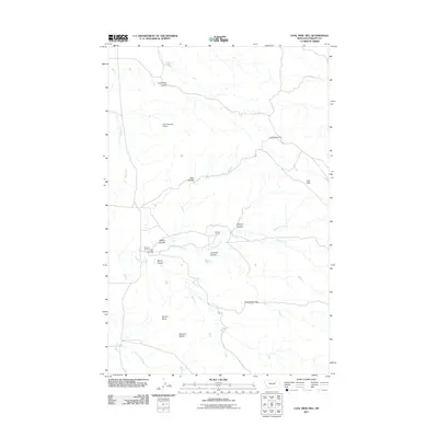
2011 Map of Coal Mine Hill
USGS Topo · Published 2011About this map
Coal Mine Hill rises over a landscape defined by an intricate network of coulees and intermittent streams in Phillips County. This 2011 survey illustrates the rural ranching character of the region, anchored by the Spencer Ranch and Barnard Ranch. The drainage patterns are particularly complex, featuring Telegraph Creek and numerous named coulees such as Coal Mine Coulee, Alfalfa Coulee, and Langton Coulee, which carve through the high plains toward larger watercourses. To the south, the terrain becomes increasingly prominent with the elevations of Square Butte and Barnard Buttes, while Shoemaker Gap provides a natural passage through the hills. Water management for livestock is evident at the Kelso Number 5 Dam, situated near the headwaters of Dog Creek. The map provides a precise view of the geographic isolation and topography of the Larb Hills before modern industrial changes or major developments altered these traditional grazing lands.
Find a feature on this map
18 named features on this map. Tap any name to fly to it.
Don’t see what you’re looking for? This feature index may not catch every label — zoom into the map to look around manually.
Map Details
Editions of this 2011 Coal Mine Hill Map
This is the sole edition of this map. No revisions or reprints were ever made.
Other maps of this area

1954 · Jordan
USGS Topo · 1:250,000

1956 · Jordan
USGS Topo · 1:250,000

1958 · Jordan
USGS Topo · 1:250,000

1964 · Jordan
USGS Topo · 1:250,000

1965 · Coal Mine Hill
USGS Topo · 1:24,000

1965 · Sun Prairie
USGS Topo · 1:24,000

1965 · Herman Point
USGS Topo · 1:24,000

1965 · Schuyler Butte
USGS Topo · 1:24,000

1965 · Buckley Lake
USGS Topo · 1:24,000

1965 · Sheep Coulee
USGS Topo · 1:24,000