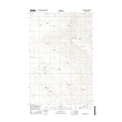
2017 Map of Coal Mine Hill
USGS Topo · Published 2017About this map
Coal Mine Hill rises above a complex drainage system in this portion of Phillips County, where the high plains are deeply incised by numerous coulees. The landscape is defined by its vertical relief and water management features, including Coal Mine Coulee, Box Elder Coulee, and Wilson Coulee in the north. To the south, the terrain becomes increasingly distinctive with landmarks such as Square Butte, Barnard Buttes, and the narrow passage of Shoemaker Gap. This area is connected by a network of rural routes like Larb Hills Rd and Telegraph Rd, which cross the drainage of Telegraph Cr. The arrangement of these roads and named geographical features like Alfalfa Coulee and Lucy Coulee reflects a history of local land use tied to the sparse water sources and prominent topographic markers used for navigation in this Montana ranching country.
Find a feature on this map
29 named features on this map. Tap any name to fly to it.
Don’t see what you’re looking for? This feature index may not catch every label — zoom into the map to look around manually.
Map Details
Editions of this 2017 Coal Mine Hill Map
This is the sole edition of this map. No revisions or reprints were ever made.
Other maps of this area

1954 · Jordan
USGS Topo · 1:250,000

1956 · Jordan
USGS Topo · 1:250,000

1958 · Jordan
USGS Topo · 1:250,000

1964 · Jordan
USGS Topo · 1:250,000

1965 · Coal Mine Hill
USGS Topo · 1:24,000

1965 · Sun Prairie
USGS Topo · 1:24,000

1965 · Herman Point
USGS Topo · 1:24,000

1965 · Schuyler Butte
USGS Topo · 1:24,000

1965 · Buckley Lake
USGS Topo · 1:24,000

1965 · Sheep Coulee
USGS Topo · 1:24,000