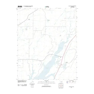
2010 Map of Coalgate SE
USGS Topo · Published 2010About this map
Atoka Reservoir dominates the landscape of this region in south-central Oklahoma, its sprawling waters fed by North Boggy Creek and several tributaries. This 2010 survey illustrates the modern hydrological management of the area, featuring substantial infrastructure such as Mcentire Lake Dam, Troly Lake Dam, and Bluestem Lake Dam. The settlement of Flora sits near the eastern shore of the reservoir, adjacent to Elm Creek and the grounds of the State Honor Farm. To the west, the rural character of the land is preserved through family-named landmarks like Phillips Hollow and historical sites including the Cairo Cemetery. The grid of county roads, including Lake Rd and N3900 Rd, provides a clear view of contemporary land divisions and accessibility to the waterfront in Atoka County.
Find a feature on this map
32 named features on this map. Tap any name to fly to it.
Don’t see what you’re looking for? This feature index may not catch every label — zoom into the map to look around manually.
Map Details
Editions of this 2010 Coalgate SE Map
This is the sole edition of this map. No revisions or reprints were ever made.
Other maps of this area

1896 · Coalgate
USGS Topo · 1:125,000

1898 · McAlester
USGS Topo · 1:125,000

1899 · Coalgate
USGS Topo · 1:125,000

1899 · Atoka
USGS Topo · 1:125,000

1900 · Atoka
USGS Topo · 1:125,000

1900 · Coalgate
USGS Topo · 1:125,000

1901 · Antlers
USGS Topo · 1:125,000

1909 · Mc Alester
USGS Topo · 1:125,000

1912 · Antlers
USGS Topo · 1:125,000

1925 · Antlers
USGS Topo · 1:125,000