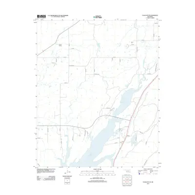
2012 Map of Coalgate SE
USGS Topo · Published 2012About this map
Atoka Reservoir dominates the landscape south of the small settlement of Flora, where the waters submerge several creek valleys in south-central Oklahoma. This 2012 survey documents the complex network of rural routes and family landmarks, such as Phillips Hollow and McEntire Lake, that define the area east of Coalgate. The terrain is marked by distinct rises like Stone Bluff Rd and the foothills of N Chockie Mountain Rd to the east. Local history and genealogy researchers will find two significant burial grounds on this sheet: Cairo Cem tucked in the northwest corner near Coal Cr, and Bethel Cem situated further east. The transition from upland ridges to the sprawling reservoir shoreline creates a varied geography of wetlands and seasonal drainages including Chilly Cr and N Boggy Cr.
Find a feature on this map
54 named features on this map. Tap any name to fly to it.
Don’t see what you’re looking for? This feature index may not catch every label — zoom into the map to look around manually.
Map Details
Editions of this 2012 Coalgate SE Map
This is the sole edition of this map. No revisions or reprints were ever made.
Other maps of this area

1896 · Coalgate
USGS Topo · 1:125,000

1898 · McAlester
USGS Topo · 1:125,000

1899 · Coalgate
USGS Topo · 1:125,000

1899 · Atoka
USGS Topo · 1:125,000

1900 · Atoka
USGS Topo · 1:125,000

1900 · Coalgate
USGS Topo · 1:125,000

1901 · Antlers
USGS Topo · 1:125,000

1909 · Mc Alester
USGS Topo · 1:125,000

1912 · Antlers
USGS Topo · 1:125,000

1925 · Antlers
USGS Topo · 1:125,000