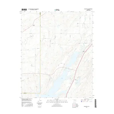
2016 Map of Coalgate SE
USGS Topo · Published 2016About this map
Atoka Reservoir dominates the lower central portion of this landscape, marking the transition where the waters of Mill Creek and Elm Creek are impounded. Along its eastern shore, the small settlement of Flora sits near Bluestem Lake and the uniquely named Sub-Penitentiary Lake. The topography is defined by the prominent Limestone Ridge that runs northeast to southwest, paralleled by South Boggy Creek. Rural life in this corner of Oklahoma is centered around family and community landmarks, evidenced by Bethel Cem in the north and Cairo Cem near the western edge. The presence of Mail Route Rd and numerous numbered section roads highlights the grid-based land management of the region, while natural features like Phillips Hollow and McEntire Lake offer specific points of interest for local historians and genealogists studying the Coal and Atoka County line.
Find a feature on this map
48 named features on this map. Tap any name to fly to it.
Don’t see what you’re looking for? This feature index may not catch every label — zoom into the map to look around manually.
Map Details
Editions of this 2016 Coalgate SE Map
This is the sole edition of this map. No revisions or reprints were ever made.
Other maps of this area

1896 · Coalgate
USGS Topo · 1:125,000

1898 · McAlester
USGS Topo · 1:125,000

1899 · Coalgate
USGS Topo · 1:125,000

1899 · Atoka
USGS Topo · 1:125,000

1900 · Atoka
USGS Topo · 1:125,000

1900 · Coalgate
USGS Topo · 1:125,000

1901 · Antlers
USGS Topo · 1:125,000

1909 · Mc Alester
USGS Topo · 1:125,000

1912 · Antlers
USGS Topo · 1:125,000

1925 · Antlers
USGS Topo · 1:125,000