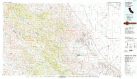
1987 Map of Coalinga
USGS Topo · Published 1987About this map
The Diablo Range and the San Andreas Rift Zone dominate this section of Central California, where the rugged terrain of Peachtree Valley and Priest Valley meets the industrial footprint of the San Joaquin Valley. In the late 1980s, the economic landscape was defined by the extensive Coalinga Oil Field, Pleasant Valley Oil Field, and Jacalitos Oil Field flanking the city of Coalinga. This geography highlights the intersection of intensive petroleum extraction and large-scale water management, evidenced by the California Aqueduct and Coalinga Canal cutting through the arid Kettleman Plain.
Find a feature on this map
59 named features on this map. Tap any name to fly to it.
Don’t see what you’re looking for? This feature index may not catch every label — zoom into the map to look around manually.
Map Details
Editions of this 1987 Coalinga Map
This is the sole edition of this map. No revisions or reprints were ever made.
Other maps of this area

1912 · Coalinga
USGS Topo · 1:125,000

1912 · San Ardo
USGS Topo · 1:31,680

1913 · Panoche
USGS Topo · 1:125,000

1914 · Lost Hills
USGS Topo · 1:125,000

1914 · Cholame
USGS Topo · 1:125,000

1915 · Priest Valley
USGS Topo · 1:125,000

1915 · Cholame
USGS Topo · 1:125,000

1917 · Cholame
USGS Topo · 1:125,000

1919 · San Miguel
USGS Topo · 1:62,500

1919 · King City
USGS Topo · 1:62,500