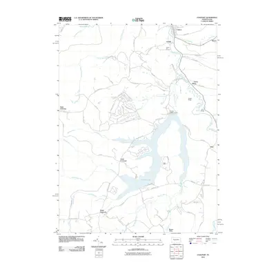
2010 Map of Coalport
USGS Topo · Published 2010About this map
Glendale Lake dominates the central landscape of this western Pennsylvania study, its irregular shoreline formed by the Glendale Dam across the waters of Clearfield Creek. This region of Beccaria Township is characterized by a network of small, interconnected settlements including Coalport, Lyleville, and Flinton that grew around the local resources and transit routes. Genealogists will find interest in several family-named landmarks such as Shelton Hill Cemetery and the crossroads communities of Nagles Crossroad and Longs Crossroad. The topography is defined by prominent ridges like Punkin Ridge and Snake Ridge, while much of the eastern shore is preserved within Prince Gallitzin State Park. The map captures the area as a mix of recreation and rural living, with numerous small runs like Killbuck Run and Wyerough Run feeding into the larger reservoir system.
Find a feature on this map
66 named features on this map. Tap any name to fly to it.
Don’t see what you’re looking for? This feature index may not catch every label — zoom into the map to look around manually.
Map Details
Editions of this 2010 Coalport Map
This is the sole edition of this map. No revisions or reprints were ever made.
Other maps of this area

1902 · Patton
USGS Topo · 1:62,500

1903 · Curwensville
USGS Topo · 1:62,500

1903 · Houtzdale
USGS Topo · 1:62,500

1904 · Patton
USGS Topo · 1:62,500

1905 · Houtzdale
USGS Topo · 1:62,500

1920 · Altoona
USGS Topo · 1:62,500

1922 · Altoona
USGS Topo · 1:62,500

1939 · Curwensville
USGS Topo · 1:62,500

1942 · Curwensville
USGS Topo · 1:62,500

1943 · Punxsutawney
USGS Topo · 1:125,000