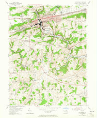
1953 Map of Coatesville
USGS Topo · Published 1965About this map
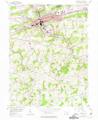
Coatesville serves as the industrial heart of this Chester County landscape, where the Reading and Pennsylvania railroads intersect along the valley floor. The urban corridor extending from Thorndale through South Coatesville to Modena is defined by its heavy rail infrastructure and proximity to the West Branch Brandywine Creek. Outside the manufacturing center, the terrain rises into the Valley Hills, giving way to a dense network of rural townships like East Fallowfield and West Marlborough. These areas are dotted with traditional landmarks of the era, including the US Veterans Hospital and numerous country schools such as Rainbow Sch and Preton Hall Sch. Local genealogy is well-represented by historic religious sites like St Malachi Ch and several burial grounds, including the Ukrainian Cem and Fairview Cemetery.
Find a feature on this map
59 named features on this map. Tap any name to fly to it.
Don’t see what you’re looking for? This feature index may not catch every label — zoom into the map to look around manually.
Map Details
Editions of this 1953 Coatesville Map
6 editions found
Other maps of this area

1901 · West Chester
USGS Topo · 1:62,500

1904 · West Chester
USGS Topo · 1:62,500

1904 · Coatesville
USGS Topo · 1:62,500

1905 · Honey Brook
USGS Topo · 1:62,500

1906 · Phoenixville
USGS Topo · 1:62,500

1906 · Coatesville
USGS Topo · 1:62,500

1907 · Honeybrook
USGS Topo · 1:62,500

1918 · Coatesville
USGS Topo · 1:62,500

1941 · Honeybrook
USGS Topo · 1:62,500

1943 · Coatesville
USGS Topo · 1:62,500