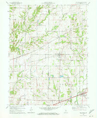
1970 Map of Coatesville
USGS Topo · Published 1972About this map
Coatesville serves as the central hub of this 1970 survey, situated along the Penn Central rail line at the border of Putnam and Hendricks counties. The surrounding landscape is defined by the headwaters and tributaries of several prominent drainage systems, including Clear Creek, Miller Creek, and the East Fork Mill Creek. The town of Stilesville anchors the southeastern corner along the historic National Road, which remains a primary transit corridor for the region.
Find a feature on this map
46 named features on this map. Tap any name to fly to it.
Don’t see what you’re looking for? This feature index may not catch every label — zoom into the map to look around manually.
Map Details
Editions of this 1970 Coatesville Map
Other maps of this area

1953 · Clayton
USGS Topo · 1:24,000

1953 · Danville
USGS Topo · 1:24,000

1953 · Indianapolis
USGS Topo · 1:250,000

1955 · Hall
USGS Topo · 1:24,000

1956 · Indianapolis
USGS Topo · 1:250,000

1956 · Cloverdale
USGS Topo · 1:24,000

1956 · Eminence
USGS Topo · 1:24,000

1957 · Indianapolis
USGS Topo · 1:250,000

1958 · Roachdale
USGS Topo · 1:24,000

1958 · Coatesville
USGS Topo · 1:24,000