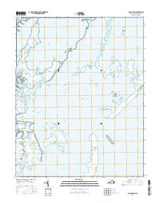
2016 Map of Cobb Island
USGS Topo · Published 2016About this map
Cobb Island and its smaller neighbor, Little Cobb Island, define the outer edge of this intricate barrier system along the Virginia coast. The landscape is dominated by an extensive network of salt marshes and tidal channels, including Ramshorn Marsh, Elkins Marsh, and Eckichy Marsh, which shift and reform under the influence of the Atlantic Ocean. These wetlands protect interior waters like Spidercrab Bay and Hog Island Bay, providing a complex environment of inlets and channels such as Sand Shoal Inlet and Mittigy Channel. The distribution of named features like Parchaby Tump and Mockhorn Island reveals the topographical variety of the Northampton County coastline, where small elevations and expansive marshes create a delicate maritime ecosystem.
Find a feature on this map
37 named features on this map. Tap any name to fly to it.
Don’t see what you’re looking for? This feature index may not catch every label — zoom into the map to look around manually.
Map Details
Editions of this 2016 Cobb Island Map
This is the sole edition of this map. No revisions or reprints were ever made.
Other maps of this area

1941 · Broadwater
USGS Topo · 1:62,500

1942 · Cheriton
USGS Topo · 1:24,000

1942 · Cobb Island
USGS Topo · 1:24,000

1942 · Great Machipongo Inlet
USGS Topo · 1:24,000

1942 · Little Machipongo Inlet
USGS Topo · 1:24,000

1942 · Nassawadox
USGS Topo · 1:24,000

1943 · Nassawadox
USGS Topo · 1:31,680

1943 · Townsend
USGS Topo · 1:24,000

1943 · Franktown
USGS Topo · 1:31,680

1946 · Eastville
USGS Topo · 1:250,000