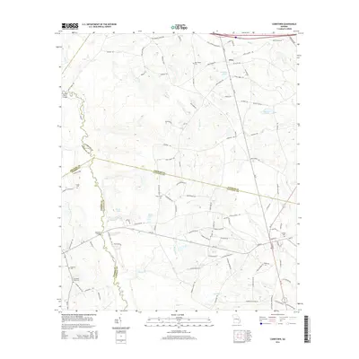
2014 Map of Cobbtown
USGS Topo · Published 2014About this map
The Ohoopee River meanders along the western boundary of this landscape, where the borders of Candler, Toombs, and Tattnall counties converge. This 2014 survey documents a predominantly rural region defined by agricultural plots and family-named roads like Mallard Rd and Jerry Collins Rd. The small community of Aline sits in the northeast, positioned near the intersection of Ga-57 and the I-16 corridor.
Find a feature on this map
104 named features on this map. Tap any name to fly to it.
Don’t see what you’re looking for? This feature index may not catch every label — zoom into the map to look around manually.
Map Details
Editions of this 2014 Cobbtown Map
This is the sole edition of this map. No revisions or reprints were ever made.
Other maps of this area

1957 · Macon
USGS Topo · 1:250,000

1958 · Macon
USGS Topo · 1:250,000

1964 · Macon
USGS Topo · 1:250,000

1970 · Cobbtown
USGS Topo · 1:24,000
1970 · Collins
USGS Topo · 1:24,000
1970 · Metter
USGS Topo · 1:24,000
1970 · Metter SE
USGS Topo · 1:24,000

1970 · Nunez
USGS Topo · 1:24,000

1970 · Ohoopee
USGS Topo · 1:24,000

1970 · Lyons
USGS Topo · 1:24,000