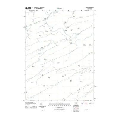
2010 Map of Coburn
USGS Topo · Published 2010About this map
Coburn serves as a focal point in this central Pennsylvania landscape, where the waters of Elk Creek and Pine Creek converge into the winding Penns Creek. The terrain is defined by a series of parallel ridges and valleys, including Second Mountain and Strong Mountain, which have historically constrained travel to gaps like Greenbrier Gap and McNitt Gap. Toward the center of the sheet, the recreational infrastructure around Poe Lake and Poe Dam within Poe Valley State Park highlights the transition of this area from industrial timber or mountain farming toward conservation and public use. The presence of a CCC Camp in the south and various named hollows such as Stillhouse Hollow and Rupp Hollow point to a history of local mountain life and government-led landscape development. Numerous runs, including Swift Run and Weikert Run, drain the high ridges of Pitchpine Ridge and Spruce Mountain, creating a complex hydrological network.
Find a feature on this map
95 named features on this map. Tap any name to fly to it.
Don’t see what you’re looking for? This feature index may not catch every label — zoom into the map to look around manually.
Map Details
Editions of this 2010 Coburn Map
This is the sole edition of this map. No revisions or reprints were ever made.
Other maps of this area

1924 · Centre Hall
USGS Topo · 1:62,500

1924 · Lewistown
USGS Topo · 1:62,500

1925 · Mifflintown
USGS Topo · 1:48,000

1927 · Lewisburg
USGS Topo · 1:62,500

1929 · Centre Hall
USGS Topo · 1:62,500

1934 · Mifflintown
USGS Topo · 1:62,500

1937 · Mifflintown
USGS Topo · 1:62,500

1937 · Millheim
USGS Topo · 1:48,000

1941 · Millheim
USGS Topo · 1:62,500

1943 · Lewistown
USGS Topo · 1:125,000