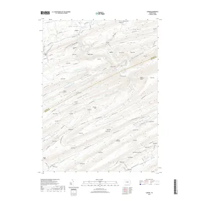
2019 Map of Coburn
USGS Topo · Published 2019About this map
Penns Valley and the northern reaches of the Seven Mountains define this 2019 survey, where the settlement of Coburn sits at the confluence of Penns Creek and Pine Creek. The landscape is dominated by a series of parallel ridges and narrow hollows, characteristic of the Ridge-and-Valley Appalachians. Notable topographic features like Stillhouse Knob, Tunnel Mtn, and Strong Mtn create natural corridors such as Little Poe Valley and Havice Valley. These gaps and valleys have long dictated the placement of mountain roads like Paddy Mountain RD and Treaster Valley RD.
Find a feature on this map
116 named features on this map. Tap any name to fly to it.
Don’t see what you’re looking for? This feature index may not catch every label — zoom into the map to look around manually.
Map Details
Editions of this 2019 Coburn Map
This is the sole edition of this map. No revisions or reprints were ever made.
Other maps of this area

1924 · Centre Hall
USGS Topo · 1:62,500

1924 · Lewistown
USGS Topo · 1:62,500

1925 · Mifflintown
USGS Topo · 1:48,000

1927 · Lewisburg
USGS Topo · 1:62,500

1929 · Centre Hall
USGS Topo · 1:62,500

1934 · Mifflintown
USGS Topo · 1:62,500

1937 · Mifflintown
USGS Topo · 1:62,500

1937 · Millheim
USGS Topo · 1:48,000

1941 · Millheim
USGS Topo · 1:62,500

1943 · Lewistown
USGS Topo · 1:125,000